
LION CITY HUB • NATIONAL EDUCATION & HERITAGE
Raffles Lighthouse Maritime Heritage
Visit a working 19th-century beacon at Singapore’s southernmost maritime turning point.
Guiding Ships Since 1855
Raffles Lighthouse stands on Pulau Satumu at the southernmost point of Singapore. Built in 1855 and named after Sir Stamford Raffles, it marks an important turn along the busy Singapore Strait. The lighthouse remains an operational aid to navigation, helping vessels travel safely through surrounding waters.
Its isolated setting also offers a clear view of shipping routes, neighbouring islands and the scale of Singapore’s maritime activity. Guided visits connect the working beacon with the country’s development as a global port. Pulau Satumu adds another layer to the story. The small island’s name is often understood as “one-tree island”, reflecting an early landmark seen by sailors.
Working Beacon shows how the area changed while retaining links to its past. The lighthouse still provides a critical visual reference for ships navigating the busy waters of the Singapore Strait. This context helps readers connect the place with Singapore's wider development.
Did You Know?
Raffles Lighthouse was built in 1855 on Pulau Satumu and continues to serve as an operational aid to navigation, in local memory and heritage today.
Its location marks Singapore’s southernmost point, where ships travelling through the strait make an important turn, and a visible link with its past.
What Makes Raffles Lighthouse Special

Raffles Lighthouse
Operating since 1855, the lighthouse on Pulau Satumu remains an active navigational beacon at Singapore’s southernmost point and a symbol of the nation’s maritime heritage. It is still remembered.
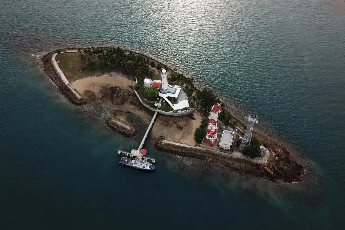
Pulau Satumu
The small island’s name is often understood as “one-tree island”, reflecting an early landmark seen by sailors. It helps visitors connect Pulau Satumu with the wider history of Raffles Lighthouse.
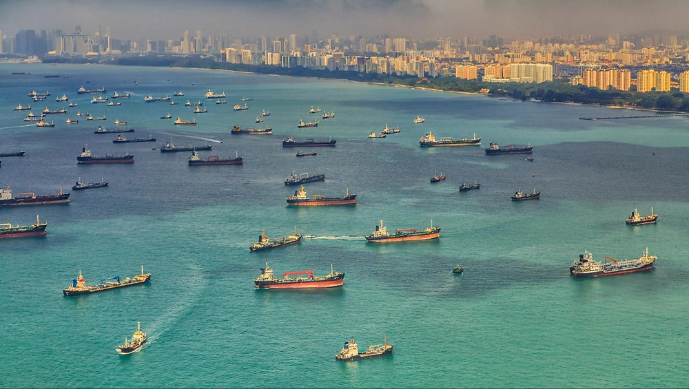
Singapore Strait Viewpoint
The lighthouse overlooks one of the world’s busiest shipping routes, where vessels turn through Singapore’s southern waters against a backdrop of islands and port activity. It still matters.

The One-Tree Island Name
Pulau Satumu is often interpreted as “one-tree island”, recalling a lone tree once used as a natural landmark by sailors approaching Singapore’s southern waters. It gives the area added character.
Trail Routes
Route 1: Faith & Multi-Religious Harmony
-
Duration: 1.5 hours on foot | Distance: 1.2 km
-
Focus: Trace South Bridge Road and Telok Ayer Street to observe Singapore’s religious co-existence, where Buddhist temples, Singapore's oldest Hindu temple, a Chulia mosque, and a Chinese Methodist church stand side by side.
Route 2: Early Immigrants & Street Life
-
Duration: 1 hour on foot | Distance: 900 m
-
Focus: Walk down Pagoda Street, Smith Street, and Sago Lane to discover the history of rickshaw pullers, Samsui women, high-density tenement living, and heritage street murals.
Route 3: Clans, Trade & Pioneer Leaders
-
Duration: 1.5 hours on foot | Distance: 1.8 km
-
Focus: Explore Bukit Pasoh Road, Club Street, and Ann Siang Hill—the historic strongholds of dialect clan associations, elite pioneer clubs, and traditional shophouse architecture.
